
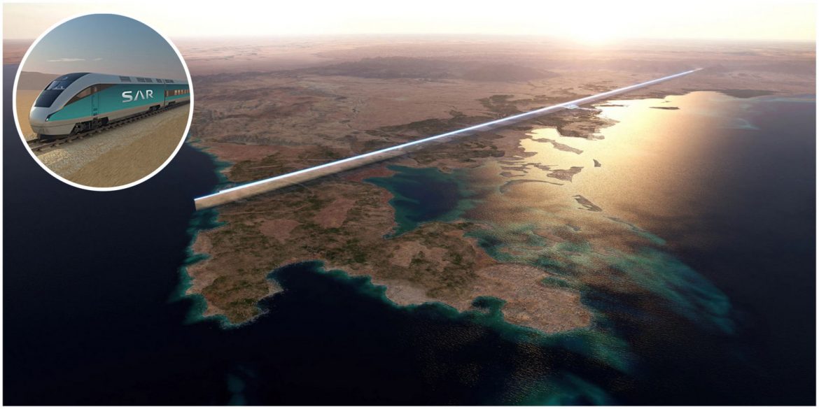
Webuild and Shibh Al Jazira Contracting (SAJCO) have been awarded a contract to construct a 57km, 230km/h passenger and freight line in Neom. The train will connect Oxagon, the region’s industrial center, and The Line, a 105-mile-long desert city. Webuild will spearhead the civil works for two high-speed and two freight railway tracks in a distinct destination after leading challenging industry projects, such as the Terzo Valico dei Giovi between Genoa and Milan.
Source: https://luxurylaunches.com/travel/saudi-arabia-line-city-high-speed-rail-line.phpNeom aims to be a futuristic city that incorporates advanced technologies and sustainable practices. One of the critical aspects of the development plan is establishing an efficient transportation system, including constructing a high-speed rail network. The ultimate goal is to connect Neom with other major cities in Saudi Arabia, such as Riyadh and Jeddah, and potentially extend into neighboring countries. The wealthy nation is also set to launch its first luxury train akin to the Orient Express, taking passengers on a 1300 km journey across the Kingdom.

- We cover themed resort developments worldwide!
- Resort Construction. Nothing else.
- Bookmark resortX. Stay up to date!
- Click here to find resortX on LinkedIn
- resortX & themeparX welcome 5 million visitors per year!
- Click here to see our founder's personal travel map
Send your construction pics to content_at_themeparxdotcom
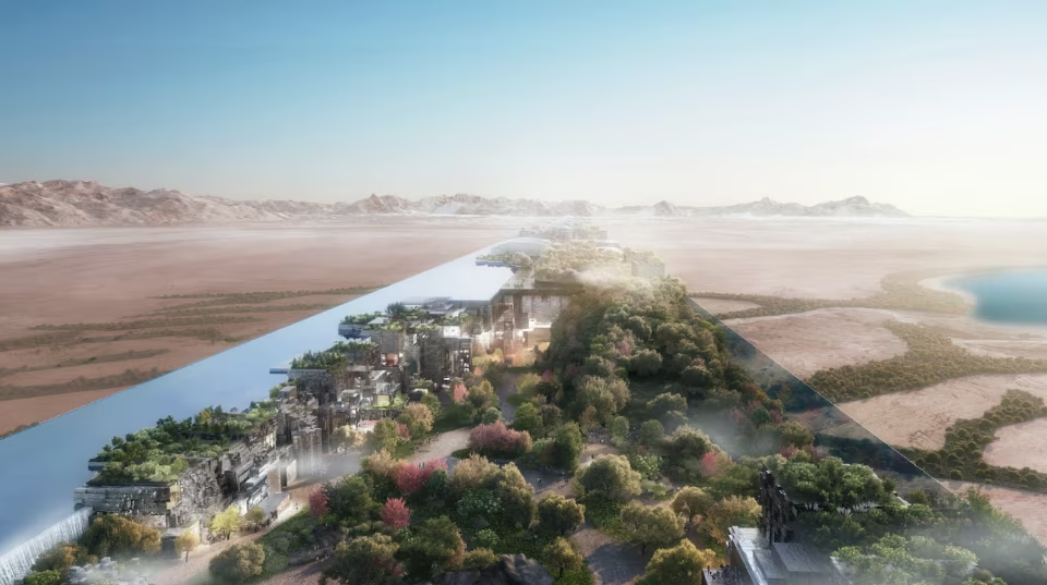
 NEOM - The Line

Views: 454,984
Subscribe
Post an Update
Posts 91 - 100 of 145
Local Name:
ذا لاين
Budget:
Announced:
10 Jan 2021
Construction Start:
Oct 2021
Opening:
2035
Location:
Area:
3367 ha
Developer:
Operator:
Consultants:
Designers:
Contractors:
Ride Suppliers:
Other Suppliers:


Designer / Consultant: Storyland Studios
Also worked on:

Other Supplier / Consultant: Vivaticket
Also worked on:

Contractor / Consultant / Other Supplier: Aspen Creations
Also worked on:

Designer / Consultant: Legacy Entertainment
Also worked on:
Designer / Consultant: Storyland Studios
Also worked on:
Other Supplier / Consultant: Vivaticket
Also worked on:
Contractor / Consultant / Other Supplier: Aspen Creations
Also worked on:
Designer / Consultant: Legacy Entertainment
Also worked on:
-
 resortX Top Investigator
- Join Date
- Jul 2019
- Posts
- 1,152
-
Guest
-
resortX Top Investigator
- Join Date
- Aug 2022
- Posts
- 54
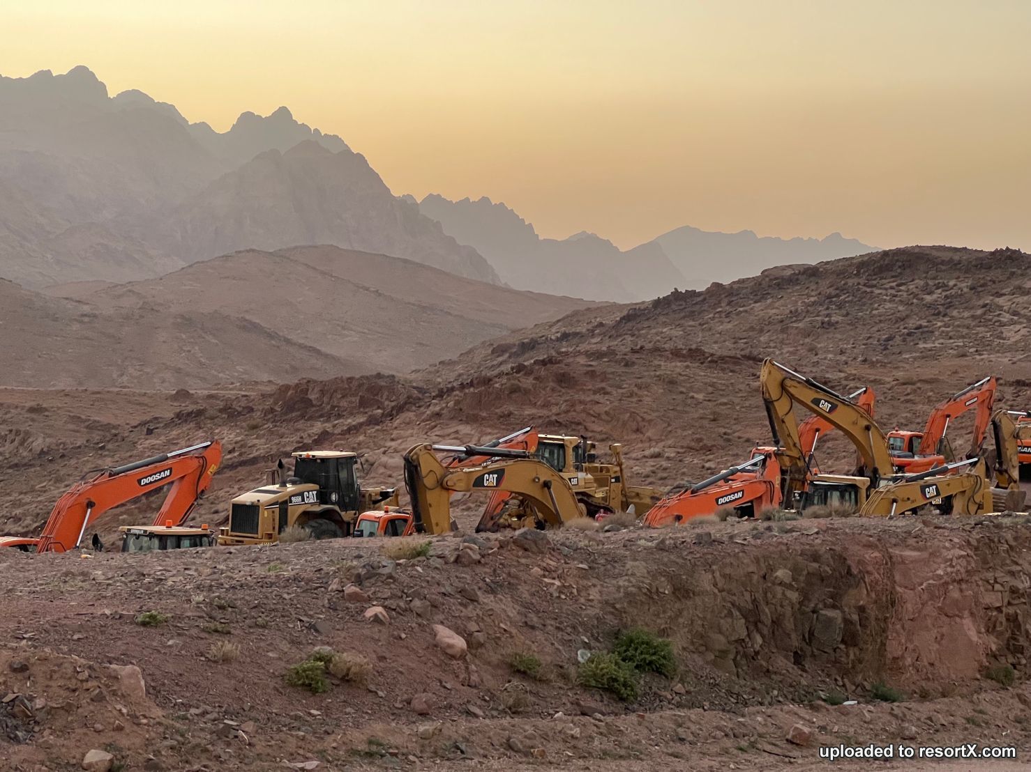
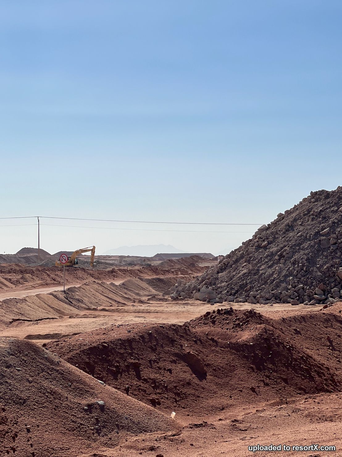
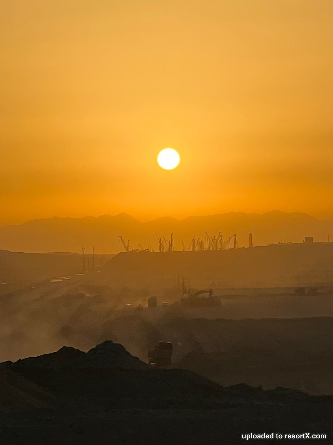
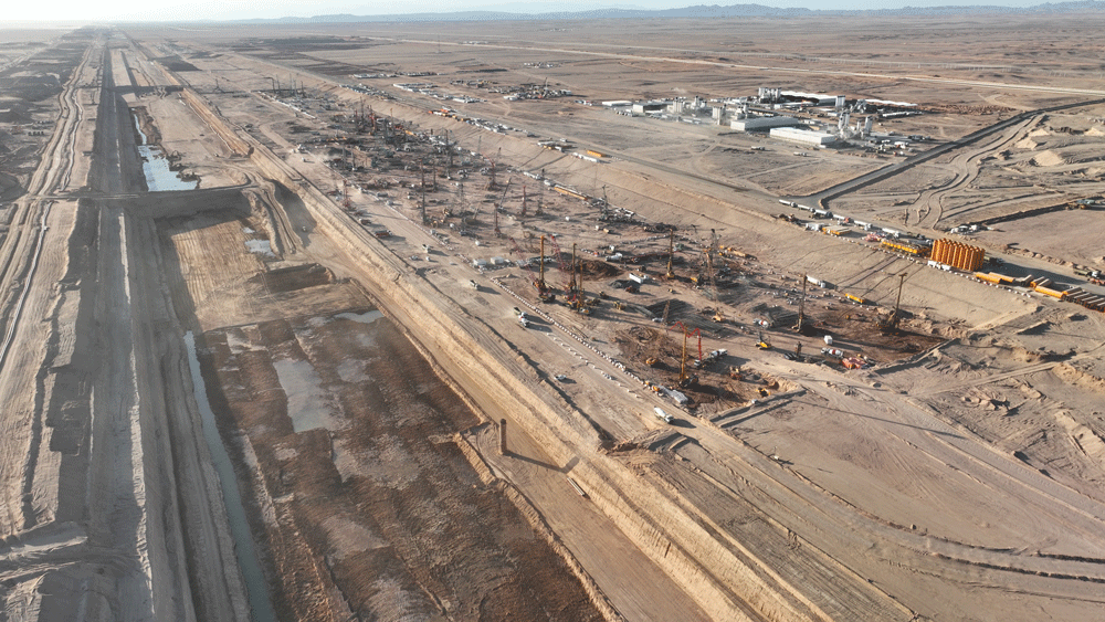
The Line: Huge #earthworks are well underway to prepare for its #construction (or at least part of it). Work is taking place at different sites along the entire length of the 170km-long project including tunnelling sites and work to create the Spine: the high speed #rail link running the length of the project. You can see significant stretches of earth that have been dug out and piled into hills. New roads run alongside the site which you can drive along and see a lot of the work underway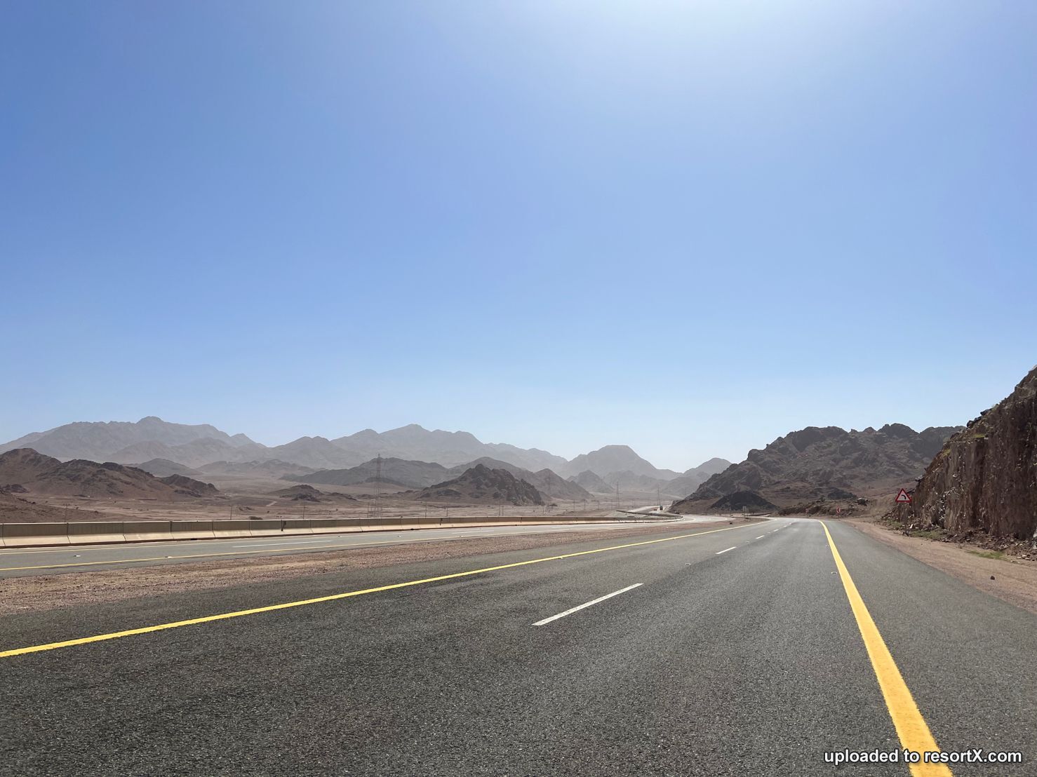
https://www.linkedin.com/posts/charlesphillipsoxford_neom-landscapes-theline-activity-7051545764988096512-YQF_?utm_source=share&utm_medium=member_desktop
-
resortX Top Investigator
- Join Date
- Jul 2019
- Posts
- 1,152
Due to the vastness of the area included in the plan, Neom recently announced plans to also launch its own airline, which is expected to be fully operational by the end of 2024.Source: https://www.domusweb.it/en/sustainable-cities/2023/04/03/neom-will-launch-its-own-airline-in-2024.htmlThe airline will allow all tourists, residents and business partners to travel to and from the megacities under construction. The airline will initially upgrade existing equipment and technologies, but plans to invest in next-generation electric, hydrogen-powered, or supersonic aircraft starting in 2026, to offer a sustainable, and digitally advanced flight experience.
-
resortX Top Investigator
- Join Date
- Mar 2016
- Posts
- 1,380
-
Guest
That is just unbelievably insane. The Line is being constructed over its entire length all at the same time?
-
resortX Top Investigator
- Join Date
- Mar 2016
- Posts
- 1,380
-
resortX Top Investigator
- Join Date
- Mar 2016
- Posts
- 1,380
-
resortX Top Investigator
- Join Date
- Jul 2019
- Posts
- 1,152
-
resortX Top Investigator
- Join Date
- Jul 2019
- Posts
- 1,152
 Reply
Reply


 Posting Permissions
- You may not post new threads
- You may post replies
- You may post attachments
- You may not edit your posts
resortX and themeparX are neutral, user-powered, and staff-moderated platforms that provide both aggregated and original news updates on theme park and resort projects worldwide. We are not affiliated with the owners or developers of the projects listed and receive no compensation from them.